
Location tool can benefit you in two major ways:
1. Data integrity and performance:
As project data keep growing in time, especially in large-scale projects (for example mega-projects that have different sections: high schools, campuses, factories, etc.) it would be a challenging task to handle and manage all different types of data. So you have to find a way to group these data into some sort of clusters (=locations in this case). Later on, you would able to filter based on the location so you only view the part of data that belongs to that location. This data load reduction would help both the Web viewer and Mobile viewer give a better experience by improving the performance.
2. Data Generation and Manipulation
This filtering can be useful in Data Manager too, in case you want to apply some changes to all data that belongs to a specific location.
One other very important use-case of Location would be helping the user during the Point Cloud generation process. If you use the Capture app during the video capture, you have to specify what location you are positioned at and track your live location on that location's drawing. We would transfer this data to our server and recommend you pick the most appropriate Point Cloud as the target to be automatically aligned to (read more about aligning to an existing point cloud here).
Before jumping into action steps, first there would a brief introduction into Location breakdown Structure concept.
Similar to any other Tree-like-structure management method (e.g. WBS), Location Breakdown Structure (LBS) also refers to a hierarchical structure that defines a parent-node relationship between different locations of the project, enabling the user to get to a granular level of breaking down different locations. 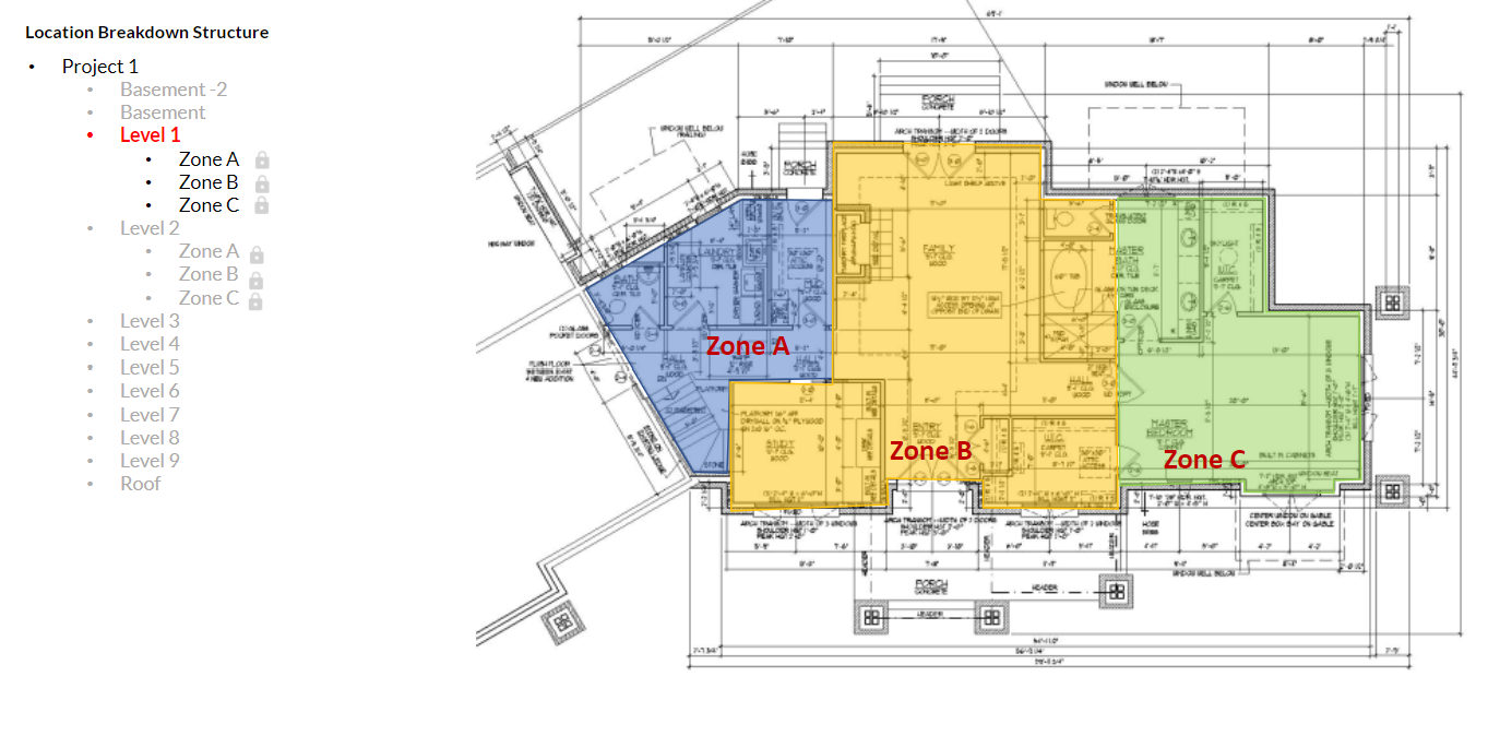
Unfortunately at this point, Reconstruct does not support Location Breakdown Structure but it would be available in the near future.
However, until then there is nothing to prevent users from creating more granular locations as opposed to a high-level location spectrum. (In the upper example, having locations defined per rooms, sections, or zones (Zone A, B, C, etc.) instead of defining them per floor (level 1, 2, 3, etc.))
As a result, you would have more number of locations defined compared to the conventional way. You may need to break down your drawing sheets and/or BIMs too before uploading them into Reconstruct to accommodate those location definitions.
Comments
0 comments
Please sign in to leave a comment.